
Review sản phẩm
Tốc độ giới hạn trên Google Maps chính xác hơn bạn tưởng!

Th5
## Tốc độ giới hạn trên Google Maps chính xác hơn bạn tưởng!
Google Maps không chỉ là ứng dụng dẫn đường thông thường. Dữ liệu về giới hạn tốc độ trên ứng dụng này được kiểm duyệt kỹ lưỡng hơn bạn nghĩ. Bài viết này sẽ tiết lộ quy trình kiểm tra nghiêm ngặt mà Google áp dụng để đảm bảo tính chính xác của thông tin tốc độ, giúp bạn lái xe an toàn và hiệu quả hơn.
Quy trình kiểm duyệt tốc độ phức tạp:
Việc xác định và cập nhật giới hạn tốc độ trên Google Maps không đơn giản chỉ là thu thập dữ liệu. Google sử dụng một hệ thống đa lớp, kết hợp nhiều nguồn dữ liệu khác nhau để đảm bảo độ chính xác cao nhất. Các nguồn dữ liệu này bao gồm:
* Dữ liệu từ chính phủ và các cơ quan chức năng: Google hợp tác với các cơ quan giao thông vận tải để thu thập thông tin chính thức về giới hạn tốc độ trên các tuyến đường. Đây là nguồn dữ liệu chính xác và đáng tin cậy nhất.
* Dữ liệu từ người dùng: Người dùng Google Maps đóng góp một phần quan trọng vào việc cập nhật dữ liệu. Hệ thống của Google sẽ nhận diện và so sánh các báo cáo về giới hạn tốc độ từ nhiều nguồn khác nhau để xác định độ tin cậy của thông tin. Những báo cáo bất thường hoặc mâu thuẫn sẽ được kiểm tra kỹ lưỡng hơn.
* Dữ liệu từ hình ảnh vệ tinh và Street View: Công nghệ hình ảnh tiên tiến của Google giúp xác định biển báo tốc độ trên đường và tự động cập nhật dữ liệu vào hệ thống. Đây là một biện pháp bổ sung quan trọng, giúp phát hiện những thay đổi về giới hạn tốc độ mà các nguồn khác chưa cập nhật.
* Hệ thống thuật toán thông minh: Google sử dụng các thuật toán học máy phức tạp để phân tích và xác thực dữ liệu từ nhiều nguồn khác nhau. Hệ thống này có khả năng phát hiện và loại bỏ những dữ liệu sai lệch, đảm bảo tính chính xác của thông tin hiển thị trên ứng dụng.
Tầm quan trọng của dữ liệu chính xác:
Dữ liệu giới hạn tốc độ chính xác trên Google Maps không chỉ giúp người dùng lái xe an toàn hơn, tuân thủ luật giao thông, mà còn giúp giảm thiểu tai nạn giao thông, góp phần vào việc xây dựng một hệ thống giao thông thông minh và hiệu quả.
Mua ngay sản phẩm công nghệ tại Queen Mobile:
Bạn đang tìm kiếm những sản phẩm công nghệ chất lượng cao với giá cả cạnh tranh? Hãy đến với QUEEN MOBILE, nhà cung cấp hàng đầu các sản phẩm điện thoại, máy tính bảng và phụ kiện chính hãng tại Việt Nam. Chúng tôi cam kết mang đến cho khách hàng trải nghiệm mua sắm tuyệt vời với dịch vụ chuyên nghiệp và sản phẩm chất lượng.
#GoogleMaps #GiớiHạnTốcĐộ #DữLiệuChínhXác #AnToànGiaoThông #QueenMobile #CôngNghệ #MuaSắmOnline #ViệtNam
(Lưu ý: Phần giới thiệu về Queen Mobile được thêm vào theo yêu cầu. Nội dung về Queen Mobile cần được bổ sung thêm thông tin cụ thể hơn để bài viết trở nên hấp dẫn và thuyết phục hơn.)
Giới thiệu Google Maps speed limit data is more thoroughly vetted than you’d think
: Google Maps speed limit data is more thoroughly vetted than you’d think
Hãy viết lại bài viết dài kèm hashtag về việc đánh giá sản phẩm và mua ngay tại Queen Mobile bằng tiếng VIệt: Google Maps speed limit data is more thoroughly vetted than you’d think
Mua ngay sản phẩm tại Việt Nam:
QUEEN MOBILE chuyên cung cấp điện thoại Iphone, máy tính bảng Ipad, đồng hồ Smartwatch và các phụ kiện APPLE và các giải pháp điện tử và nhà thông minh. Queen Mobile rất hân hạnh được phục vụ quý khách….
_____________________________________________________
Mua #Điện_thoại #iphone #ipad #macbook #samsung #xiaomi #poco #oppo #snapdragon giá tốt, hãy ghé [𝑸𝑼𝑬𝑬𝑵 𝑴𝑶𝑩𝑰𝑳𝑬]
✿ 149 Hòa Bình, phường Hiệp Tân, quận Tân Phú, TP HCM
✿ 402B, Hai Bà Trưng, P Tân Định, Q 1, HCM
✿ 287 đường 3/2 P 10, Q 10, HCM
Hotline (miễn phí) 19003190
Thu cũ đổi mới
Rẻ hơn hoàn tiền
Góp 0%
Thời gian làm việc: 9h – 21h.
KẾT LUẬN
Hãy viết đoạn tóm tắt về nội dung bằng tiếng việt kích thích người mua: Google Maps speed limit data is more thoroughly vetted than you’d think
Summary
- Google Maps uses a combination of AI and imagery, including Street View, to ensure the accuracy of its speed limit display feature.
- The speed limit data is not solely reliant on one source of data, as speed limits can fluctuate based on various factors.
- The meticulously curated speed limit data is crucial for the evolving world of automotive tech and plays a role in ensuring road safety.
We often take for granted the small, yet incredibly beneficial features embedded within our everyday apps — a perfect example would be the speed limit display on Google Maps. But have you ever wondered how Google ensures the accuracy of these speed limits as you drive from one location to another? We’ve always assumed some combination of Street View imagery and AI was at play, but it turns out the process is a bit more complex than most would imagine.
Speed limits, undeniably, are crucial for ensuring road safety. However, recognizing the current speed limit can sometimes be a challenge, especially when driving in unfamiliar territories or during challenging weather conditions. Google Maps offers a solution by displaying speed limit data for roads across the globe.
To keep this data precise, Google doesn’t solely rely on the official data from local governments, even though this data provides default speed limits for various road types. There are many roads where the speed limit might fluctuate depending on factors like time of day or prevailing weather conditions. To grasp these intricacies, Google employs both imagery and artificial intelligence. Its advanced AI models are adept at extracting speed limit information from diverse sources, including its own Street View imagery and third-party visuals. By training these models on countless types of speed limit signs worldwide, Google ensures that the AI can distinguish speed limits, whether they’re from the U.S. or Germany.
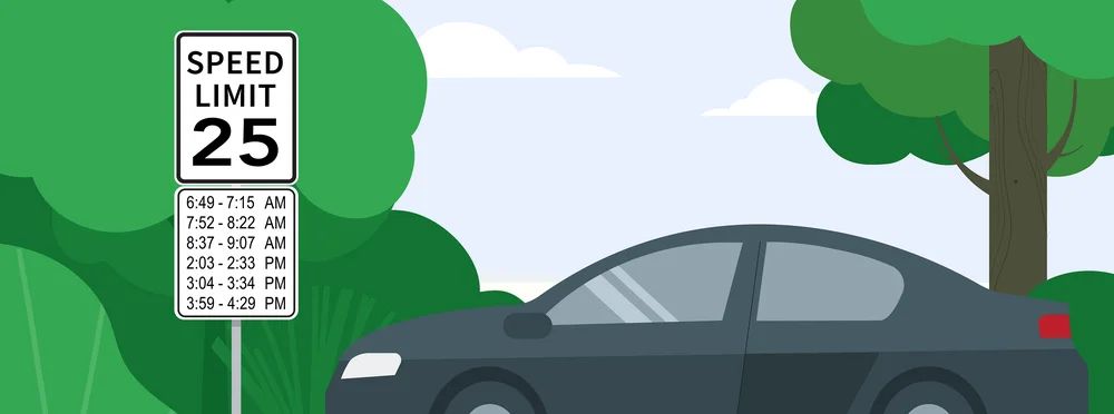
However, the journey doesn’t stop at just identifying speed limits. Roads are dynamic, with speed limits evolving due to construction, feedback from communities, or changing traffic conditions. If a road’s speed limit is consistently defied, it might be indicative of a change. Perhaps a school has been constructed nearby, or the local authorities identified the area as accident-prone.
When Google Maps detects potential updates in speed limits, the system doesn’t hastily amend the data. Instead, it cross-references the change with multiple sources, like official data from local authorities or freshly captured Street View images. If recent images aren’t available, they seek help from third-party partners who routinely gather road information for various purposes, such as enhancing delivery routes.
Beyond just assisting drivers, this meticulously curated speed limit data plays an essential role in the evolving world of automotive tech. With increasing emphasis on cars equipped with assisted or fully autonomous driving features, the need for accurate speed limit data has never been more critical. Regulatory bodies are now stepping in, like the EU’s General Safety Regulations, which mandates new vehicles to have an intelligent speed assistance feature that continuously displays the correct speed limit.
While the speed limit display in Google Maps might seem like a trivial feature, the intricacy and diligence behind its functionality are immense. It’s a prime example of how technology, when used effectively, can make our daily travels safer and more informed.

Khám phá thêm từ Phụ Kiện Đỉnh
Đăng ký để nhận các bài đăng mới nhất được gửi đến email của bạn.